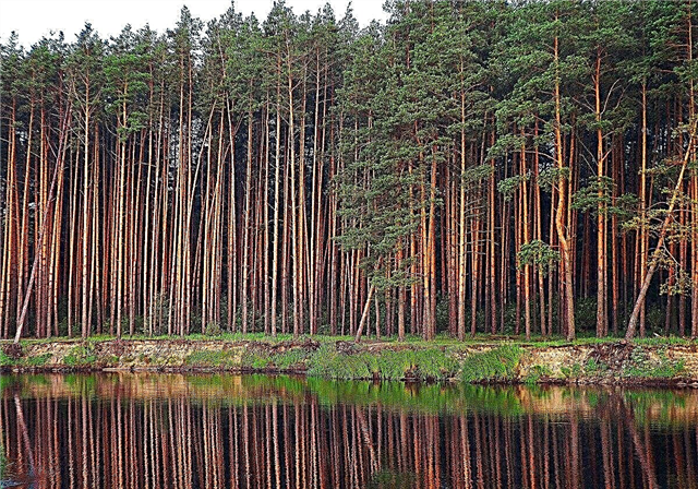
In total, the border of the Russian Federation stretches for 60.9 thousand km. The border service in this vast space is carried by more than 180 thousand border guards.
Not all borders of Russia are finalized by international treaties. Territorial disputes with Ukraine, the southern Caucasus and the Baltic zone are still ongoing.
Let's see how the longest land borders of Russia evolved.
10. Lithuania (288.4 km)

After World War II was established border between the RSFSR and the Republic of Lithuania. The border of East Prussia, established in 1923 by the accession of the Klaipeda (Memel) Region to Lithuania, was adopted as the basic reference point.
In 1939, Germany again annexed the territory of East Prussia. After 1945, the border returned to its former place and became internal (intra-union).
In 1997, an agreement was signed that eliminated some of the absurdities of the border. For example, there was no longer a boundary separation of reservoirs. It is this agreement, starting in 2003, that defines the territorial delimitation of the states of the Republic of Lithuania and the Russian Federation. Currently, the border length is 288.4 km.
9. Azerbaijan (350 km)

Talking about Russian-Azerbaijani border, we should not forget that Dagestan, which is a subject of the Russian Federation, borders directly with Azerbaijan. The total length of the border (including the sea section) is about 350 km.
Modern reference points were not at all smoothly coordinated. The current state is determined by the agreement, which entered into force in 2011. A big problem in relations between peoples was that due to the natural topography, many natural resources have to be used together. These are automobile roads (first of all, passes) and water resources. The question of the division of the Samur River Basin was very acute.
8. Estonia (467 km)

The border treaty between the countries was signed in 2014. But it still has not come into full force. The agreement specifically states that territorial disputes are resolved finally and to the mutual satisfaction of the parties.
The border with a total length of about 470 km has been the subject of regular disputes since 1991. Estonia believed that it has rights to part of the Pskov region and Ivangorod.
In 2005, the parties tried to agree on the recognition of borders within the framework of the administrative division of the USSR - but the Estonian side made such significant amendments to the draft treaty that the document would not be signed by Russia.
7. Georgia (480 km)

The Georgian Democratic Republic proclaimed its state building in 1918 - a hundred years after the start of the accession of certain Caucasian kingdoms and principalities to the Russian Empire. No wonder 1920 RSFSR and Georgia officially recognized each other’s state status.
The intra-union border between the Georgian SSR and the RSFSR existed from 1922 to 1991. Moreover, in the period 1944 to 1958, the territory of Georgia expanded due to the annexation of the territories of Karachay-Cherkessia and Chechnya.
After the collapse of the USSR, territorial disputes and border conflicts between the republics (including the self-proclaimed ones) of the South Caucasus immediately began.
After the military conflict in 2008, the border between the Russian Federation and Georgia was significantly reduced. If before the conflict its length was almost 900 km, now it consists of two sections with a total length of 480 km (moreover, 180 km of them are still the subject of disagreement).
6. Belarus (1239 km)

Oddly enough, the border with this completely “fraternal Slavic state” has not yet been determined definitively. Moreover, a very formal status leads to the fact that it actually exists in the form of separate checkpoints and customs points. In the intervals between the checkpoint, the border, as such, is absent and the pedestrian crossings are unlimited.
The conventional line, passing through control points and formally coinciding with the former intra-Union border within the USSR, has a length of about 1240 km. Its location on the map was established in 1993 by a resolution of the Supreme Council of the Republic. Belarus.
In 2017, the Russian Federation reinstated the need for customs control at the checkpoint, which was legally abolished in 1995.
5. Finland (1325.8 km)

One of the oldest state borders of the Russian Empire (and since 1991 the Russian Federation). Back in the 14th century (1323) the Orekhovets Peace Treaty was signed, which determined the eastern border of Sweden with the Moscow Kingdom. The 1595 peace agreement extended the land border to adjacent maritime territories.
Finland as an independent state it was isolated only in 1809, thus inheriting the eastern border 1323 km long (at that time). Moreover, Finland became part of the Russian Empire and until 1917 the border was internal, without special border control.
In 1940 (after the Soviet-Finnish War) the border between the USSR and Finland was slightly shifted; the next change in line was enshrined in the Paris Treaty of 1947 as a result of World War II. Now its length (with marine sites) is 1325.8 km.
4. Ukraine (2245.8 km)

Before the events of 2014 (annexation of Crimea to Russia) border with Ukraine had a length of 2295 km. It passed along the historical (since 1954) border between the Ukrainian SSR and the RSFSR from north to south from the junction of the three borders (Belarus, the RSFSR and Ukraine) to the Kerch Strait.
After the annexation of Crimea, an additional 735 km long border section with the Russian Federation was formed (of which only 8.6 km pass by land). Now the total length of all border sections is about 2246 km.
3. Mongolia (3,484.85 km)
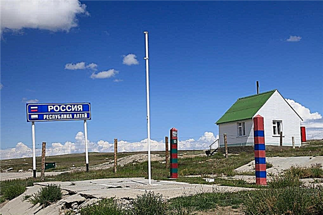
One of our longest borders. Of the 3,485 km of total length, about 2,880 km is land. It passes mainly through inaccessible and sparsely populated places and consists of demarcation sites between Mongolia, Tuva, Trans-Baikal Territory, Buryatia and the Altai Republic.
Historically, it was the border between the Russian and Qing Empires. But in 1911 Mongolia proclaimed independence from North China and concluded its own peace treaties.
The specificity of the border areas (especially the traditional way of life of the population) leads to the fact that the main headache of the border guards is drug smuggling and regular mutual theft of livestock.
2. China (4209.3 km)

In a modern form border between the Russian Federation and China took shape only in 2005. Now its length is 4209 km, with only 650 km passing by land. The rest is laid along the fairways of border rivers and lake basins.
Russian-Chinese relations have always been tense. Historically (starting from the conquest of Siberia), Russia constantly claimed in the territory of Central Asia, and China included modern Mongolia in the composition. In 1932, due to the creation of a pro-Japanese puppet government in Manchuria, China completely lost the land border with the RSFSR.
It reappeared only in 1948 (after the return of Inner Manchuria to China). Since 1953, China has constantly made territorial claims to the USSR. It even reached open military conflicts.
1. Kazakhstan (7598.6 km)

The longest of the continuous sections of the state border of the Russian Federation. Historically, it took its full shape in these outlines back in 1933-34. in the form of borders between the Kazakh SSR and the RSFSR and has a length of almost 7600 km, of which 5936 km pass by land.
In 2015, the government Of Kazakhstan suggested the Russian Federation a mutual exchange of certain territories. It was noted that the territories are not the subject of controversy, and the essence of the exchange is only to increase the economic efficiency of individual farms. It is not surprising, because the same nationalities and nationalities live on both sides of the border.